

What is Architectural Site Analysis?
Architectural site analysis involves examining various factors related to a specific location for a building or project.
This includes looking at things like where the site is located, how big it is, the shape of the land, any rules or regulations for building there,
how busy the area’s roads are, and the typical weather conditions.
The analysis also takes into account any future plans or changes that could affect the site, like new roads being built or other important buildings being constructed nearby.
By considering all these factors, architects can make informed decisions about how to design and plan the project to best fit the site and its surroundings.
Why do you carry out an architectural site analysis?
architect site analysis check
Before beginning any design work, it is important for the client to determine if it is possible to construct a building on the chosen site.
A comprehensive site analysis, also known as a context analysis, is conducted to evaluate the financial feasibility of the development and establish guidelines for implementing the best design that considers the physical and environmental characteristics of the site.
This analysis helps the client understand if the project is financially viable and provides crucial information to create a design that is well-suited to the site’s unique features and surroundings.
What kind of information are we collecting?
Our analysis data can be divided into two main categories: hard data and soft data.
Hard data includes factual and tangible information about the site, such as:
- Location: The specific area where the site is situated.
- Neighbourhood context: Details about the immediate surroundings, including zoning information, nearby buildings, and any other factors that may impact the project.
- Zoning and size: Considerations related to dimensional aspects like property boundaries, easements, height restrictions, site area, and access. It also involves understanding any future development plans for the area.
- Legal information: Ownership details, restrictions or covenants, council-related information, and any future urban development plans that may affect the site.
Soft data includes qualitative information and observations about the site, such as:
- Natural physical features: Notable natural elements present on the site, like trees, rocks, topography, rivers, ponds, and drainage patterns.
- Manmade features: Existing buildings, walls, local architectural styles, setbacks, materials, landscaping, and the overall scale of the surrounding area.
- Circulation: Analysis of vehicle and pedestrian movements within and around the site, considering timing, duration of peak traffic, and any future road developments that may impact accessibility.
- Utilities: Information about the availability and proximity of essential services like electricity, gas, water, sewer, and telephone connections, including details like distances, depths, and materials used.
- Climate: Data related to the site’s climatic conditions, such as rainfall, snowfall, wind directions, temperatures, and sun path, with consideration for seasonal variations.
- Sensory aspects: Evaluation of the site’s visual, auditory, and tactile qualities, including factors like views, noise levels, and other sensory experiences. These assessments can be conducted over different timeframes and may influence the site’s overall desirability.
- Human and cultural factors: Consideration of the cultural, psychological, behavioural, and sociological aspects of the surrounding neighbourhood. This includes analyzing activities, population density, ethnic patterns, employment, income levels, values, and other relevant socio-cultural factors.
Desktop Study
Before you physically visit a site, conducting a desktop study can provide you with valuable information. By conducting thorough research from your office or workspace, you can arrive at the site well-informed and potentially already aware of specific things you need to check or look out for during your visit.
During the desktop study, you can gather information such as: architect site analysis check
- Site history: Research the background and historical context of the site, including any previous land use, construction, or significant events that may have occurred there.
- Property records: Review property records to understand ownership details, legal restrictions, and any past or current developments on the site.
- Maps and satellite imagery: Examine maps and satellite imagery to visualize the site’s location, boundaries, topography, and surrounding features.
- Planning and zoning information: Study planning and zoning documents to understand the regulations, restrictions, and future development plans that may affect the site.
- Environmental considerations: Look for any environmental factors that may impact the site, such as proximity to protected areas, flood zones, or contaminated land.
- Infrastructure and utilities: Identify the availability and proximity of essential infrastructure and utility services, including electricity, water, sewerage, and telecommunications.
- Traffic and transportation: Research traffic conditions, transportation networks, and nearby roadways to understand the accessibility and potential impacts on the site.
- Climate and weather patterns: Obtain climate data, including average temperatures, rainfall, wind patterns, and any specific weather conditions relevant to the site’s location.
Visiting the Site
What to take with you for your architecture site analysis
When visiting a potential or proposed site for your design project, it is important to bring certain items with you. Depending on the project, you should consider taking the following:
- Camera: An essential tool for capturing photographs of the site, its surroundings, and any specific features or conditions you want to document.
- Smartphone: In addition to a camera, a smartphone can be useful for taking notes, accessing reference materials or online resources, and communicating with others involved in the project.
- Notebook: A notebook or notepad allows you to jot down important observations, measurements, sketches, or any other information relevant to the site and your design considerations.
- Tape measure: Bringing a tape measure enables you to accurately measure dimensions, distances, or specific site elements that may be relevant to your design.
- Personal Protective Equipment (PPE): Depending on the site’s conditions and safety requirements, you may need to bring PPE such as hard hats, safety glasses, gloves, or high-visibility vests. Ensure you have the necessary PPE to protect yourself while visiting the site.
- Good weather: While not an item, it is important to consider the weather conditions. Choose a day with good weather for your site visit to ensure clear visibility and better overall conditions for conducting observations and assessments.
Architecture Site Analysis Checklist
- Site and surroundings: Understanding the physical characteristics of the site and its immediate surroundings, such as its location, size, shape, topography, and natural features like trees, rocks, or water bodies.
- Neighbourhood context: Examining the surrounding area, including neighbouring buildings, infrastructure, and the overall character of the neighbourhood. This helps to understand the context in which the site is situated and its relationship to the surrounding environment. architect site analysis check
- Site and Zoning: Assessing the site’s zoning regulations, legal restrictions, and any dimensional considerations like boundaries, easements, or height restrictions. This information helps determine the site’s development potential and any limitations that need to be considered.
- Manmade features: Analyzing the existing built environment, including buildings, walls, materials, landscaping, and the overall scale and character of the surrounding structures. This provides insight into the architectural context and helps inform design decisions.
- Circulation: Studying the movement of vehicles and pedestrians in and around the site, including traffic patterns, access points, and any existing or planned road developments. This information helps assess transportation connectivity and accessibility.
- Utilities: Identifying the availability and location of essential utility services, such as electricity, gas, water, sewer, and telecommunications. Understanding the proximity and accessibility of these services is crucial for planning and design purposes.
- Sensory: Considering the visual, auditory, and tactile aspects of the site, including views, noise levels, and other sensory experiences. This evaluation helps understand the sensory qualities of the site and their impact on the overall user experience.
- Human and Cultural: Examining the social and cultural aspects of the neighbourhood, including demographics, cultural patterns, employment, income levels, and values. This analysis provides insights into the community context and can influence design decisions.
- Climate: Assessing the climatic conditions of the site, such as rainfall, temperature, wind patterns, and sun path. Understanding the climate helps inform design strategies for energy efficiency, thermal comfort, and sustainable practices.
- Site and surroundings
- Neighbourhood context
- Site and Zoning
- Manmade features
- Circulation
- Utilities
- Sensory
- Human and Cultural
- Climate
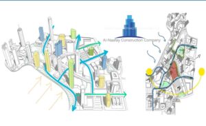
Diagramming your findings
When you have gathered a lot of information or data, presenting it through diagrams can be an effective way to communicate your findings in a clear and visual manner.
Diagrams use visual elements such as charts, graphs, and illustrations to represent data in an easy-to-understand format. Here’s why diagrams are a great choice
- Simplification: Diagrams simplify complex information by breaking it down into visual elements. They help condense a large amount of data into easily digestible chunks.
- Visualization: Visual representations are often easier for people to comprehend and remember compared to raw data. Diagrams allow you to see patterns, trends, and relationships within the data quickly.
- Clarity: Diagrams provide a clear and organized structure that makes it easier for viewers to grasp the main points. architect site analysis check
They remove unnecessary details and focus on presenting the most important aspects of the data. - Comparison: Diagrams enable easy comparison between different data sets. By using visual elements like bar charts or line graphs, you can quickly identify similarities, differences, or changes over time.
- Communication: Diagrams are a universal language that can transcend language barriers.
They facilitate effective communication, especially when dealing with diverse audiences or stakeholders who may have different levels of technical knowledge. - Engagement: Visuals tend to be more engaging and captivating than lengthy textual explanations. Diagrams can capture the attention of your audience, making it more likely that they will pay attention to your data and understand its significance.
- Decision-making: Well-designed diagrams can help in decision-making processes by providing a clear overview of the data.
They allow stakeholders to identify trends, outliers, or areas that require attention, enabling informed and data-driven decision-making.
Remember to choose the appropriate type of diagram based on the nature of your data and the message you want to convey. Some commonly used diagrams include bar charts, line graphs, pie charts, scatter plots, flowcharts, and diagrams such as Venn diagrams or organizational charts
Evaluating Your Site Visit
Once you have gathered a significant amount of information and captured numerous photos, the next step is to evaluate this data and analyze its implications for your design process.
Alongside this evaluation, you need to ensure that you integrate the requirements outlined in the brief.
As you progress, you will begin to connect the different elements, forming a comprehensive understanding that will contribute to the creation of a great design.
Here are some straightforward steps to guide you architect site analysis
- Review the information: Take a thorough look at all the data you have collected, including photos, notes, and any other relevant materials. Familiarize yourself with the details and ensure you have a clear understanding of the information at hand.
- Identify patterns and trends: Look for recurring themes or patterns within the data. Identify any notable trends or relationships that emerge. This could include common preferences, recurring issues, or specific user needs.
- Consider implications: Analyze the implications of the gathered information on your design process. Reflect on how the data might impact various aspects, such as functionality, aesthetics, user experience, or technical feasibility. Consider both the positive aspects and any potential challenges or constraints.
- Evaluate against the brief: Review the requirements stated in the design brief. Assess how the collected information aligns with these specifications. Identify areas where the data supports the brief and areas where it may require further refinement or adjustment.
- Connect the pieces: Begin to connect the different elements of the puzzle by linking the insights from the data with the requirements of the brief. Look for ways to integrate the information you have gathered into your design concept. Consider how the data can inform decisions regarding form, materials, features, or user interactions.
- Iterate and refine: As you put together the pieces of the puzzle, be prepared to iterate and refine your design. It’s likely that new insights will arise and ideas will evolve as you progress. Embrace this iterative process and allow the data to guide you towards a more robust and effective design solution.
The Site
- Street patterns
- Street section
- Scale and the hierarchy/form/space
- Land use
- Typologies
- Neighbourhood relationships, formal street variation
- Perspective relationships, views
- Edge conditions, surfaces and materials
- Natural and man-made
- Movement and circulation within and around the site
- Vehicle vs. pedestrian
- Access
- Public space vs. private space
- Open space
- History
- Climate – sun angles and sun shadows
- Negative and positive spaces – we move through negative spaces and dwell in positive spaces
- architect site analysis check

architect site analysis check
The Building
Think about how your proposal is going to link in with the site, and how the site will connect with the building. Make a few notes about each of the points below about what you are looking to achieve.
- Massing
- Structure
- Circulation
- Axis
- Symmetry
- Scale and proportion
- Balance
- Regulating lines
- Light quality
- Rhythm and repetition
- Views
- Geometry
- Hierarchy
- Enclosure
- Space/void relationship
Presenting your Site Analysis
Quick Links
Social Icons
Contact Us Information
443 J3 Johar Town Lahore near Expo Center Lahore