
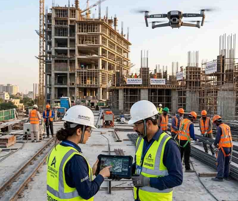
Drones on the Job Site: Real Uses and Real Limitations
Construction has always been a complex business. Managing large teams, tracking progress across sprawling sites, and keeping projects on schedule are challenges that every contractor knows well. However, a new tool is changing the way construction professionals approach these challenges — and it flies.
Drones on the job site are no longer a novelty. They are fast becoming a practical, everyday part of how modern construction projects are planned, monitored, and delivered. From aerial surveying to safety inspections, the applications are growing rapidly. At the same time, drones come with real limitations that every construction professional needs to understand before investing in the technology.
In this guide, we will walk you through exactly what construction drones are, how they are being used right now, what holds them back, and where the technology is headed. Whether you manage a small residential build or a large commercial development, this post will give you a clear, honest picture of what drones can — and cannot — do on the job site.
Table of Contents
- What Are Drones on the Job Site?
- Real Uses of Drones in Construction
- How Drones Help Construction Companies in Lahore
- Drones for Site Surveying and Mapping
- Drones for Safety Inspections on Job Sites
- Drones for Progress Monitoring and Reporting
- Real Limitations of Drones on Construction Sites
- Regulatory and Legal Challenges of Using Job Site Drones
- The Future of Drones in Construction
- FAQs
- Conclusion
What Are Drones on the Job Site?
Before diving into specific applications, it helps to understand what we actually mean when we talk about drones on the job site. A construction drone — also called an Unmanned Aerial Vehicle (UAV) — is a remotely controlled or autonomous aircraft equipped with cameras, sensors, and data collection tools. These devices can fly over a construction site and capture images, video footage, thermal data, and precise measurements from the air.
Unlike consumer drones used for photography, construction-grade drones are purpose-built for professional environments. They are typically more durable, carry higher-resolution cameras, and can be integrated with software platforms that process and analyze the data they collect. Popular models used in construction include the DJI Matrice series, the senseFly eBee, and the Skydio 2+.
The core value of drones on the job site is their ability to gather accurate, real-time information from positions and angles that would otherwise require expensive equipment or significant time. Furthermore, they can cover large areas quickly — a task that would take a survey crew several days can often be completed by a drone in a matter of hours.
It is also worth noting that construction drones work best when paired with dedicated software. Platforms like DroneDeploy, Pix4D, and Propeller Aero process drone-captured data and turn it into actionable outputs — including 3D models, orthomosaic maps, and volumetric measurements. Therefore, the drone itself is only part of the equation.
Real Uses of Drones in Construction
The range of practical applications for construction site drones has expanded significantly over the past decade. As a result, more construction companies are incorporating them into their standard workflows. Below are the most impactful and widely adopted uses currently seen across the industry.
Aerial Photography and Videography: The most immediate use of a drone on a construction site is capturing high-quality images and video from the air. This footage is useful for marketing, client presentations, stakeholder updates, and documentation. Moreover, aerial visuals give project managers a perspective that is simply not achievable from ground level.
Topographic Surveys and Mapping: Drones equipped with GPS and photogrammetry software can produce highly accurate topographic maps of a site. These maps support earthwork calculations, grading plans, and cut-and-fill analysis. Consequently, survey work that once required large field crews and days of effort can now be completed far more quickly and at a lower cost.
Progress Monitoring: By flying regular drone missions over a construction site, project managers can track exactly how much work has been completed and compare it against the project schedule. Additionally, this data can be shared with clients and stakeholders remotely, reducing the need for site visits.
Safety Inspections: Drones allow safety officers to inspect hard-to-reach areas — such as rooftops, elevated structures, and confined spaces — without putting workers at risk. This not only improves safety outcomes but also speeds up the inspection process.
Volumetric Measurements: Drones can calculate stockpile volumes with impressive accuracy. Rather than manually measuring piles of earth, aggregate, or materials, site teams can fly a drone over the stockpile and receive an accurate volume reading within minutes.
Site Security: Some construction companies use drones to monitor their sites after hours, deterring theft and vandalism. Paired with automated flight paths and motion detection systems, drones can serve as a cost-effective security solution.
Each of these applications delivers clear, measurable benefits. Nevertheless, as we will discuss later in this guide, each also comes with its own set of constraints.
How Drones Help Construction Companies in Lahore
Pakistan's construction industry is expanding at a significant pace, and Lahore sits at the center of that growth. Large-scale commercial developments, residential communities, and infrastructure projects are reshaping the city's landscape year by year. Naturally, this growth brings increased complexity — and that is precisely where construction drones can make a meaningful difference.
A forward-thinking construction company in Lahore that adopts drone technology gains several immediate advantages. First, drone-based surveying dramatically reduces the time needed to collect site data. Instead of deploying large field teams for topographic surveys, a single drone operator can complete the same task in a fraction of the time. This efficiency translates directly into cost savings and faster project timelines.
Second, drones improve communication between site teams, project managers, and clients. Rather than relying on written reports and still photographs, a construction company in Lahore can share aerial footage and data-rich maps that give everyone a clear, real-time view of project progress. This level of transparency builds client trust and reduces disputes.
Third, safety is a critical concern on any busy construction site in Lahore. Drones allow safety officers to inspect elevated structures, scaffolding, and other hazardous areas without requiring workers to physically access those locations. As a result, the risk of accidents during inspections is significantly reduced.
Of course, there are also practical challenges to drone adoption in Lahore. Regulatory awareness remains limited among some local firms, and the upfront investment in quality hardware and software can be a barrier for smaller contractors. However, companies that make the investment today will find themselves in a much stronger competitive position as client expectations for data-driven project management continue to rise. A construction company in Lahore that can offer drone-based surveying, progress monitoring, and safety inspection capabilities is well-positioned to win more sophisticated, higher-value contracts.
Drones for Site Surveying and Mapping
Of all the applications for drones on the job site, surveying and mapping may be the most transformative. Traditional land surveying is accurate, but it is also slow, labor-intensive, and expensive. Drone-based surveying, on the other hand, combines speed with a level of accuracy that meets or exceeds the requirements of most construction projects.
Here is how the process typically works. A drone is programmed to fly a predetermined path over the survey area, capturing hundreds or even thousands of overlapping images. These images are then processed using photogrammetry software, which stitches them together to create a detailed orthomosaic map — essentially a highly accurate, scaled aerial photograph of the site. In addition to this flat map, the software can generate a 3D point cloud or digital elevation model (DEM) that represents the terrain in three dimensions.
The accuracy of drone surveys is impressive. Modern systems can achieve horizontal accuracy within 2 to 5 centimeters when ground control points (GCPs) are used. Consequently, the output is suitable for a wide range of engineering and planning tasks, including earthwork calculations, drainage design, and building layout.
Beyond the initial site survey, drones are also used for as-built mapping — capturing the actual conditions of a completed structure or earthwork and comparing them against the original design. This verification process helps identify discrepancies early, before they become expensive problems. Furthermore, regular repeat surveys throughout the life of a project create a valuable data record that can be used for claims management, reporting, and future planning.
One practical tip worth noting: the quality of drone survey data depends heavily on proper planning. Before flying, site teams should place and accurately measure GCPs, plan flight paths to ensure adequate image overlap, and account for wind conditions and lighting. Taking the time to plan properly makes a significant difference in the accuracy and usefulness of the final data.
Drones for Safety Inspections on Job Sites
Construction sites are inherently hazardous environments. Falls from height remain one of the leading causes of fatalities in the industry. Therefore, any technology that allows safety officers to inspect elevated or hazardous areas without putting workers at risk deserves serious attention.
Drones on the job site are proving to be a genuinely valuable safety tool. Inspections of rooftops, tall structures, scaffolding systems, and crane components can now be completed remotely, using a drone equipped with a high-resolution camera or thermal imaging sensor. Not only does this protect workers from the risks associated with physical access, but it also allows inspectors to capture detailed visual records of everything they observe.
Thermal imaging drones add another layer of capability. These systems detect heat signatures that are invisible to the naked eye, making them useful for identifying issues such as moisture infiltration, inadequate insulation, and electrical faults. In fact, thermal drone inspections are increasingly being used to assess the condition of roofing membranes, facade cladding, and mechanical systems on large commercial buildings.
Additionally, drones are being used to monitor general site conditions in real time. By flying regular observation missions, safety teams can identify hazards such as unsecured materials, improperly erected scaffolding, and inadequate fall protection from a safe distance. When a potential hazard is spotted, the relevant team can be alerted immediately. As a result, issues can be addressed before they lead to an incident.
It is worth emphasizing, however, that drone-based safety inspections work best as a complement to — not a replacement for — traditional on-the-ground safety processes. Drones provide a valuable aerial perspective, but they cannot replicate the judgment and experience of a qualified safety officer conducting a thorough physical inspection.
Drones for Progress Monitoring and Reporting
Keeping a construction project on schedule requires accurate, up-to-date information about what has been built and what remains. Traditionally, progress monitoring has relied on site walks, photographs, and written reports — a process that is time-consuming and often produces incomplete information.
Drones on the job site are transforming progress monitoring in a fundamental way. By flying regular missions over the construction site — typically weekly or biweekly — project teams can capture a comprehensive, data-rich record of conditions at any given point in time. This aerial data is then processed and compared against the project's BIM model or construction schedule to assess progress with a level of precision that was previously impossible without significant manual effort.
Several software platforms now automate much of this comparison process. For example, DroneDeploy can overlay drone-captured imagery onto design drawings, allowing project managers to see at a glance which elements are on track and which are falling behind. Consequently, decisions can be made faster and with much greater confidence.
Progress monitoring drones are also changing the way contractors communicate with clients. Rather than presenting clients with written reports and static photographs, project teams can share interactive aerial maps and annotated imagery that tell a clear, visual story of project progress. This level of transparency tends to build client confidence and reduce the risk of disputes over milestones and payment claims.
From a practical standpoint, the key to effective drone-based progress monitoring is consistency. Flying at the same altitude, along the same flight path, and at regular intervals ensures that the data collected at different points in time is directly comparable. Consistency, therefore, is just as important as the quality of the equipment being used.
Real Limitations of Drones on Construction Sites
Having covered the many benefits of construction drones, it is equally important to discuss their limitations honestly. Understanding where drones fall short helps construction professionals make informed decisions about where and how to deploy them.
Weather Dependency: Drones cannot operate safely in heavy rain, strong winds, or fog. Since construction projects run year-round regardless of the weather, there will inevitably be days when drone operations are not possible. This can create gaps in data collection that affect the reliability of progress monitoring and survey programs.
Limited Payload Capacity: Most commercial drones have a relatively limited payload capacity. While this is sufficient for cameras and sensors, it rules out many potential delivery or heavy equipment applications that some futurists have speculated about. Practically speaking, the drone on your construction site is a data collection tool — not a workhorse.
Battery Life and Range: Even the best commercial drones have a flight time of approximately 30 to 45 minutes per battery charge. For large construction sites, this may mean multiple flights are required to cover the entire area, which adds time and complexity to operations. Furthermore, most drones must maintain a line of sight with the operator, which limits their effective range.
Data Processing Time: Collecting drone data is only the first step. Processing that data into usable outputs — maps, 3D models, and measurements — takes time and requires specialized software. Depending on the size of the site and the complexity of the data, processing can take hours or even longer. Therefore, construction teams should not expect drone data to be instantly available.
Operator Skill Requirements: Flying a construction drone effectively is not as straightforward as flying a consumer product. Professional-grade drones require skilled operators who understand photogrammetry, flight planning, and data quality control. Hiring or training qualified drone operators adds to the overall cost of a drone program.
Privacy Concerns: Drones capture imagery of everything within their field of view — including neighboring properties, public spaces, and people. Construction companies must be mindful of privacy laws and take appropriate steps to ensure that drone operations do not infringe on the rights of those in surrounding areas.
Cybersecurity Risks: As drones become more connected and data-driven, cybersecurity becomes a genuine concern. Drone data — including site layouts, structural details, and progress information — is commercially sensitive. Protecting this data from unauthorized access requires careful attention to data storage and transmission practices.
Regulatory and Legal Challenges of Using Job Site Drones
Beyond the technical limitations discussed above, regulatory and legal considerations present some of the most significant challenges to using drones on construction sites. Rules governing drone operations vary widely between countries and regions, and navigating them can be complex.
In many countries, commercial drone operations require the operator to hold a specific license or certification. For example, in the United States, the Federal Aviation Administration (FAA) requires commercial drone operators to pass a knowledge test and obtain a Part 107 certification. Similarly, in the United Kingdom, the Civil Aviation Authority (CAA) requires operators to register their drones and obtain appropriate qualifications before conducting commercial flights.
In Pakistan, the Pakistan Civil Aviation Authority (PCAA) regulates drone operations. Under current rules, operators are required to obtain a No Objection Certificate (NOC) before flying drones for commercial purposes. Additionally, flights near airports, military installations, and certain government buildings are restricted or prohibited. Construction companies operating in Lahore and other Pakistani cities must be fully aware of these requirements before deploying drones on their sites.
Airspace restrictions are another important consideration. Construction sites in urban areas are often located near airports, helipads, or other controlled airspace. Before flying drones on the job site, operators must check the local airspace rules and, where necessary, obtain the appropriate approvals from aviation authorities.
Insurance is also a critical factor. Accidents involving drones can cause property damage or personal injury. Therefore, construction companies should ensure that their drone operations are covered by appropriate liability insurance. Some jurisdictions make this a legal requirement; others simply make it a matter of common sense.
Finally, construction companies should be aware of potential conflicts with subcontractors, neighboring property owners, and workers on-site. Developing a clear drone operations policy — including rules about when and where drones can fly, who is authorized to operate them, and how the data they collect will be used — helps avoid misunderstandings and disputes.
The Future of Drones in Construction
Despite their current limitations, the trajectory of drone technology points clearly in one direction: these tools are going to become more capable, more affordable, and more deeply integrated into construction workflows in the years ahead.
Autonomous Flight: Today, most construction drones require a skilled human operator to plan and execute flights. However, advances in autonomous flight technology mean that future drones will be capable of planning and executing their own missions based on predefined objectives. As a result, the need for specialist operators will be reduced, and drone programs will become more accessible to smaller companies.
Extended Flight Times: Battery technology continues to improve, and some manufacturers are exploring hybrid power systems that combine electric and fuel-powered propulsion. Consequently, future drones will be capable of flying for longer periods and covering larger areas on a single charge.
Integration with BIM: The integration of drone-captured data with Building Information Modeling platforms is already underway, but it will become far more seamless in the future. Real-time data flows between drones and BIM models will enable continuous, automated comparison of as-built conditions against design intent. This level of integration will make progress monitoring faster, more accurate, and more actionable than ever before.
AI-Powered Analysis: Artificial intelligence is increasingly being applied to drone-captured imagery to automate tasks that currently require manual review. For example, AI systems can automatically identify cracks in concrete, measure the extent of water infiltration on a roof, or flag safety hazards visible in aerial footage. As this technology matures, it will dramatically increase the value that drones on the job site deliver.
Swarm Technology: Researchers are developing systems that allow multiple drones to work together in coordinated swarms. On a large construction site, a swarm of drones could simultaneously survey multiple areas, dramatically reducing the time required to collect site data. While swarm technology is still in its early stages, its potential applications in construction are significant.
Expanded Regulatory Frameworks: As drone technology matures and its safety record improves, regulatory frameworks around the world are expected to evolve in ways that make commercial drone operations easier and more flexible. This includes the potential for beyond-visual-line-of-sight (BVLOS) operations, which would allow drones to cover much larger areas without the current line-of-sight restriction.
Taken together, these trends suggest that the role of drones on the job site will only grow in the years ahead. Companies that build their drone capabilities now will be better positioned to take advantage of these advances as they become available.
FAQs
What types of drones are most commonly used on construction sites?
The most commonly used construction drones are multi-rotor UAVs — particularly quadcopters and hexacopters — because of their stability and ease of operation. Fixed-wing drones are also used for large-scale surveying projects, as they can cover greater distances on a single battery charge. The most popular brands in the construction sector include DJI, senseFly, and Skydio.
How accurate is drone surveying compared to traditional surveying methods?
When properly executed — including the use of ground control points (GCPs) — drone surveys can achieve horizontal accuracy within 2 to 5 centimeters. This level of accuracy is sufficient for most construction applications, including earthwork calculations and building layout verification. Traditional total station surveys can achieve higher precision in specific point measurements, but for capturing large areas quickly, drone surveying offers a compelling balance of speed and accuracy.
Do I need a license to operate a drone on a construction site?
In most countries, yes. Commercial drone operations typically require the operator to hold a specific license or certification. In Pakistan, the PCAA requires operators to obtain a No Objection Certificate (NOC) for commercial drone flights. Additionally, operators should be familiar with local airspace restrictions and insurance requirements. It is strongly advisable to consult with a qualified aviation authority or legal advisor before starting a commercial drone program.
How often should drones fly over a construction site for progress monitoring?
The optimal frequency depends on the pace of work and the reporting requirements of the project. In general, weekly or biweekly drone missions provide a good balance between data richness and operational effort. Faster-moving projects — or those with strict milestone reporting requirements — may benefit from more frequent flights.
Can drones replace human safety inspectors on construction sites?
No. Drones are a valuable complement to human safety inspections, but they cannot replace them. Drones provide an excellent aerial perspective and allow inspectors to observe areas that are difficult or dangerous to access physically. However, they lack the judgment, experience, and sensory capabilities of a qualified safety officer conducting a thorough on-the-ground inspection. The most effective safety programs use drones alongside — not instead of — traditional inspection methods.
What software is needed to process drone data collected on a construction site?
Several dedicated platforms are widely used in construction. DroneDeploy is one of the most popular options, offering automated flight planning, data processing, and integration with project management tools. Pix4D is widely used for photogrammetry and precision mapping. Propeller Aero is another strong option, particularly for earthwork and volume tracking. The best choice depends on the specific applications and the size of the construction program.
Are drones cost-effective for small construction projects?
For very small or short-duration projects, the upfront cost of drone equipment and software may not be justified. However, as drone technology becomes more affordable and drone-as-a-service providers become more common, even smaller projects can access drone capabilities on a pay-per-flight basis. Many construction companies find that the cost savings from faster surveys and improved progress monitoring quickly offset the investment, even on mid-sized projects.
How is drone data kept secure on a construction site?
Data security is an important consideration for any drone program. Best practices include storing drone data on secure, encrypted servers, restricting access to authorized personnel only, and using reputable software platforms with strong data protection policies. Additionally, construction companies should develop clear internal policies about who owns the drone data and how it may be shared with third parties.
Conclusion
Drones on the job site represent one of the most practical and immediately impactful technology shifts in modern construction. The ability to survey large areas quickly, monitor progress from the air, inspect hazardous locations safely, and calculate stockpile volumes with precision — all of these capabilities deliver real value to construction teams today.
At the same time, it is important to approach drone adoption with clear expectations. Weather dependency, battery limitations, regulatory requirements, and data processing demands are all genuine challenges that must be planned for carefully. The companies that benefit most from job site drones are those that take the time to build proper programs — with trained operators, appropriate software, and clear operational policies — rather than simply purchasing a drone and hoping for the best.
Whether you are managing a large infrastructure project, running a commercial development, or operating as a construction company in Lahore looking to modernize your workflows, drones offer a compelling opportunity. The technology is maturing rapidly, costs are coming down, and the data that drones produce is becoming more integrated and more actionable with each passing year.
If your organization has not yet explored what drones on the job site could do for your projects, now is the right time to start. Speak with a specialist, run a pilot program on your next project, and see the difference that aerial data can make. The future of construction site management is increasingly aerial — and the teams that adapt will be the ones that lead.
